免費線上雲朵辨識與雲分類|AI 天氣助手
上傳天空照片,以 AI 即時完成雲朵辨識與雲分類。認識積雲、層雲、捲雲等常見雲型,以及典型天氣、出現高度與形成過程,適合學生、攝影愛好者與天氣科普學習。
雲彩收集

Stratocumulus
Grayish-white in color with rounded, puffy mass formations separated by thin gaps; moderate thickness suggesting potential for light precipitation though none visible; flat cloud base consistent with low-altitude positioning; textured surface with subtle undulations; overall extensive coverage of the sky.
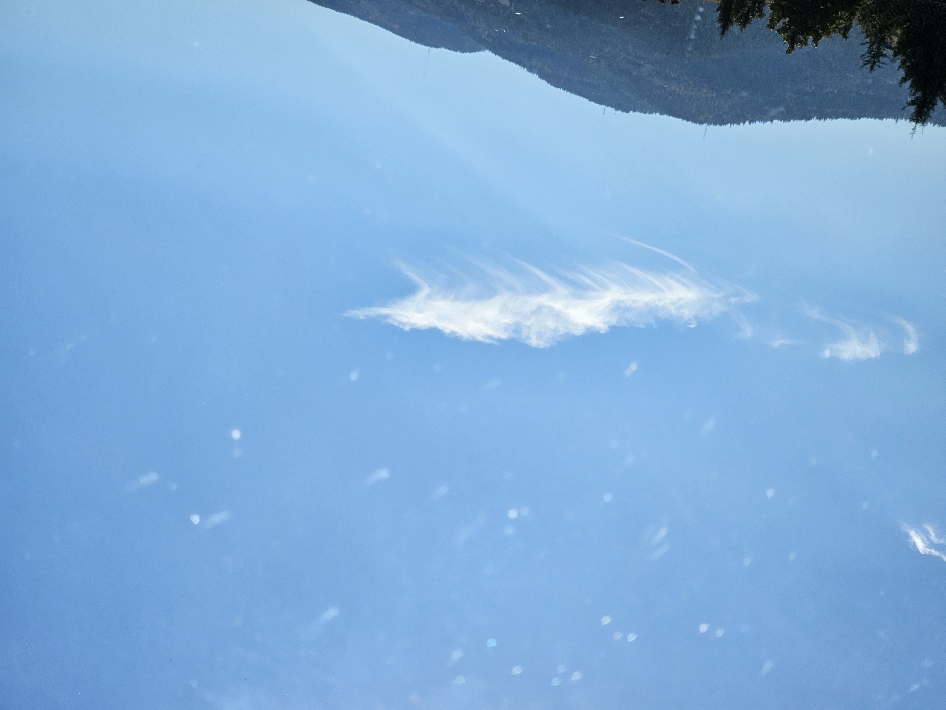
Cirrus
Thin, wispy, high-altitude clouds with delicate, hair-like structures displaying subtle wave patterns. Appears predominantly white against the clear blue sky withexcellent contrast. Has feathery, fibrous texture with minimal vertical extension. Cloud top appears slightly textured with fine, hair-like formations. No precipitation visible, positioned high in the sky with flat base.
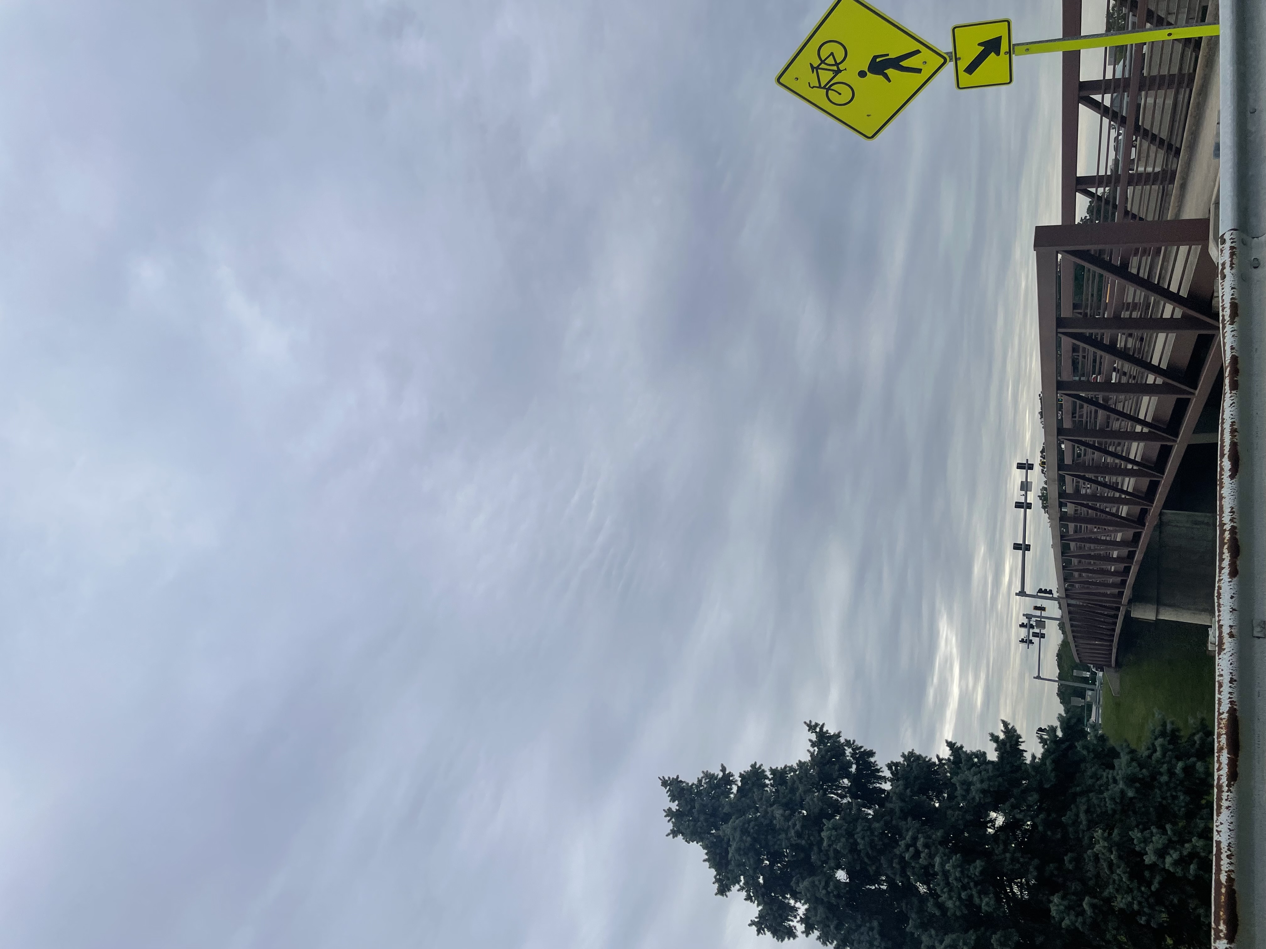
Stratocumulus
The identified cloud is Stratocumulus, characterized by extensive coverage of the sky with a relatively flat base featuring gentle, wave-like undulations creating textured patterns. The clouds exhibit a grayish hue with subtle brightness variations across their surface, showing soft, diffused edges without sharp boundaries. There is no significant vertical development, and the cloud tops maintain a gradual transition upward from the base. Precipitation is not visibly present, nor are halo or iridescence phenomena evident. The cloud base remains consistently elevated above the ground level, suggesting a mid-low altitude position.

Cumulus humilis
The identified cloud consists of numerous small,rounded, white puffy formations with subtle gray undersides. Each cloud exhibits minimal vertical development, maintaining rounded domelike tops with slightly irregular edges. The clouds is soft and cotton-like, contrasting against the blue sky. Clouds are distributed without significant clustering, with bases appearing relatively uniform in elevation. No precipitation or halo phenomena are visible.
Cirrus
The identified cloud exhibits thin, wispy, and feathery texture with elongated, filamentous formations. It appears pale white against the deep blue sky, with smooth edges and no visible precipitation. Its shape is predominantly linear with subtle variations in density, indicating delicate ice crystal structures. The cloud has a high altitude placement, suggesting it forms at elevations of approximately 6-12 kilometers.
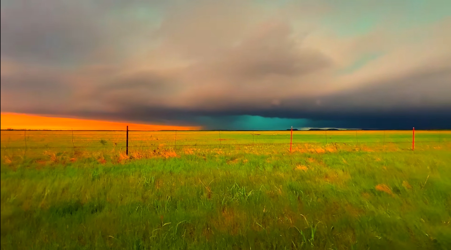
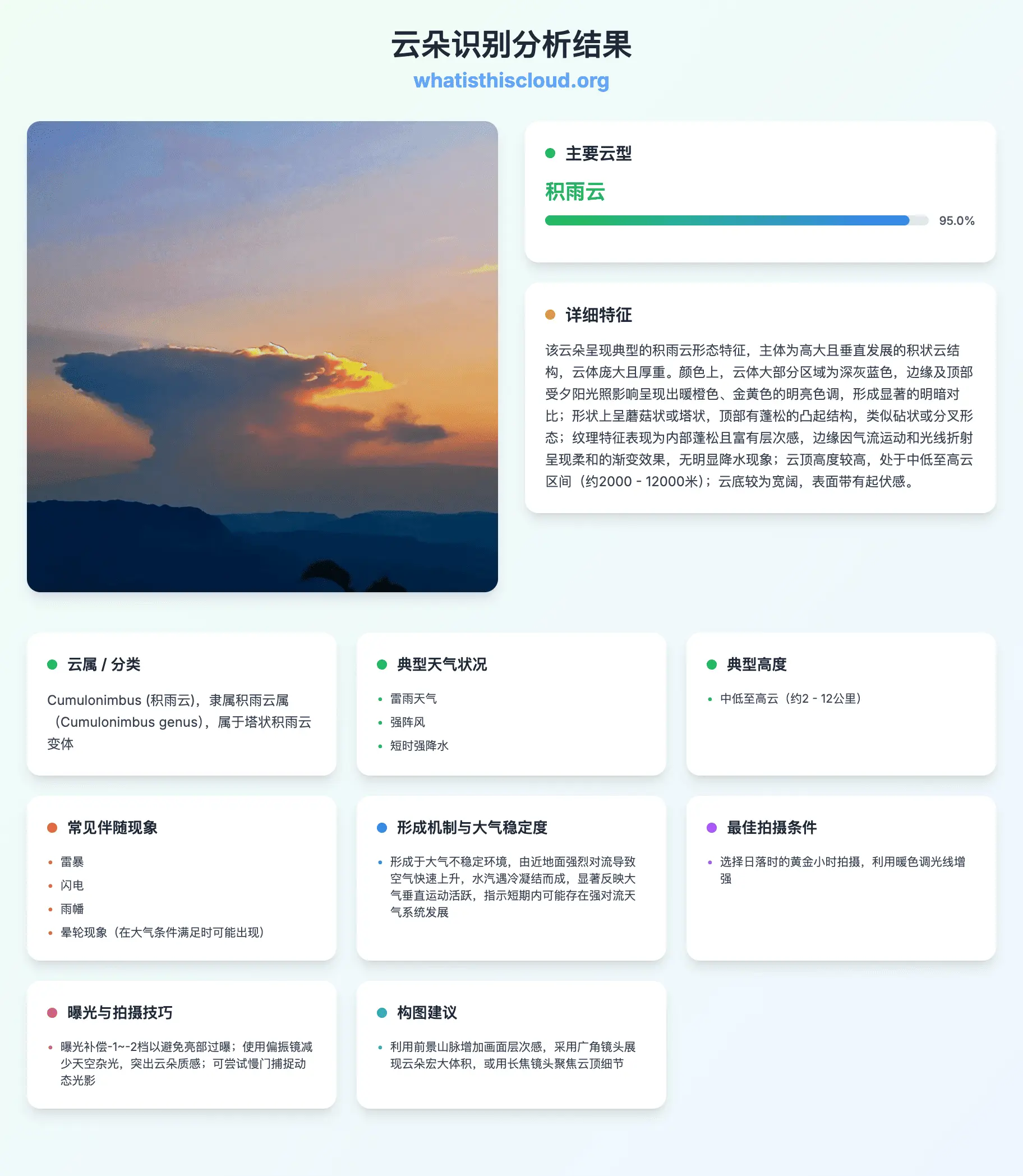
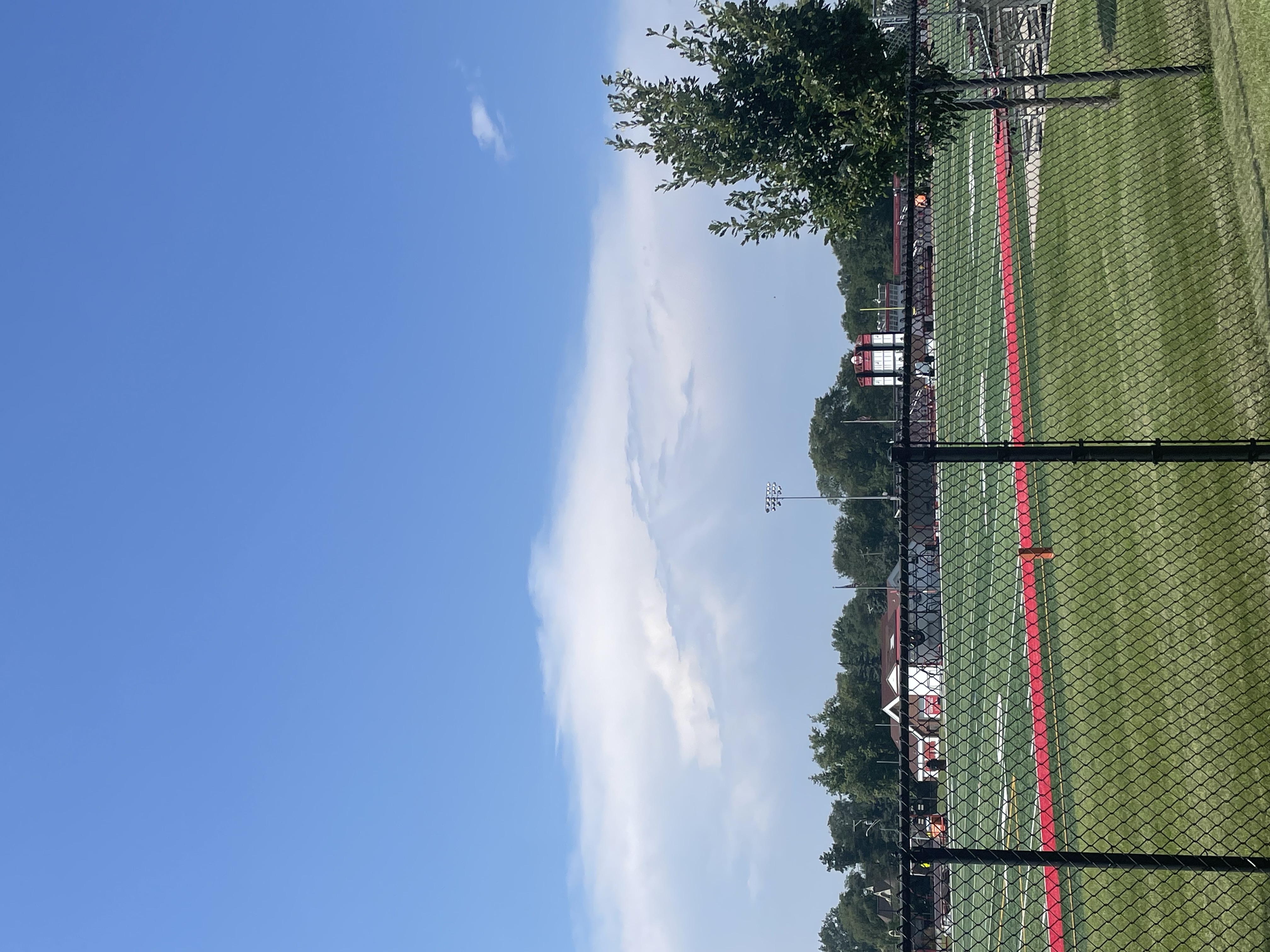
Cumulonimbus
Dominant cloud formation with extensive vertical development, dark gray/blackbase transitioning to lighter gray toward the anvil-shaped cloud top. The cloud exhibits a dense, textured appearance indicative of heavy moisture content. The base is relatively flat while the upper portions show characteristic anvil spreading due to wind shear at higher altitudes. A subtle turquoise hue near the cloud base may indicate updrafts and potential precipitation. The overall structure suggests a mature thunderstorm cloud system.
天空與天氣學習者的選擇
為什麼使用我們的雲朵辨識工具?
面向雲分類、天氣科普與高品質天空攝影
AI 雲象辨識
以真實天空照片訓練,區分主要雲屬與常見雲種,辨識更穩定
秒級分類結果
快速取得雲型、結構線索與背景說明,適合戶外隨手查、作業參考
結合氣象學語境
將雲型對應典型天氣、高度帶與形成過程,貼近國際雲圖思路
免費體驗
可先免費試用雲朵辨識;需要更多次數時再升級積分方案
行動裝置友善
手機隨拍隨傳,智慧型手機、平板與電腦瀏覽器皆可使用
講解更完整
了解雲體特徵、拍攝建議,以及雲層可能預示的天氣變化
雲朵辨識與雲分類如何運作
上傳天空照片
上傳或拍攝一張能清楚看到雲層與天空背景的照片。
AI 分析
模型綜合形狀、紋理、高度線索與環境資訊,推斷最可能的雲型。
查看報告
閱讀分類結果、相似雲型、典型天氣與高度,並取得天空攝影建議。
雲朵辨識與雲分類常見問題
什麼是雲朵辨識?這裡的「分類」指的是什麼?
雲朵辨識是把您看到的天空現象對應到氣象學中的雲型名稱(如積雲、捲雲)。分類通常依雲的外形、高度與結構,對應雲屬、雲種、變種等國際雲圖體系。上傳清晰天空照片後,AI 會給出最可能的雲型並以通俗語言說明。
AI 雲朵辨識有多準?
準確度受照片品質、光線與場景典型程度影響。邊緣清晰、色彩自然、天空背景充足,有助區分相近雲層(例如層雲與雨層雲)。結果宜作科普與學習參考,不能取代官方天氣預報或航空氣象資料。
這個工具免費嗎?
可以先在免費額度內體驗;若經常需要做雲朵辨識與分類,可升級獲得更多積分。具體次數請查看價格頁說明。
能辨識哪些雲型?
系統面向主要雲屬與常見雲種,例如積雲、層雲、層積雲、高積雲、高層雲、雨層雲、捲雲、捲積雲、捲層雲、積雨雲等,以及在影像中可辨的相關變種。
什麼樣的照片最適合雲朵辨識?
盡量在白天拍攝,避免天空嚴重過曝,並包含雲底、雲頂或層狀紋理等結構資訊。全景往往優於極小局部;若太陽在雲層後方,有時輪廓更清晰,利於分類。
可以在手機上使用嗎?
可以。網站適配手機版,可用系統相機拍照後上傳,在戶外或散步結束後隨時查看辨識與分類結果。