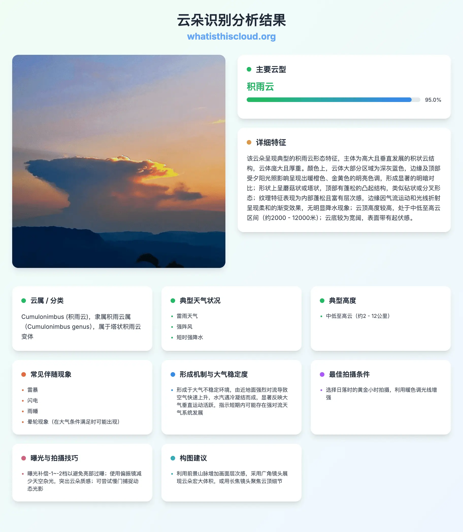
云彩收集

Stratocumulus
Grayish-white in color with rounded, puffy mass formations separated by thin gaps; moderate thickness suggesting potential for light precipitation though none visible; flat cloud base consistent with low-altitude positioning; textured surface with subtle undulations; overall extensive coverage of the sky.
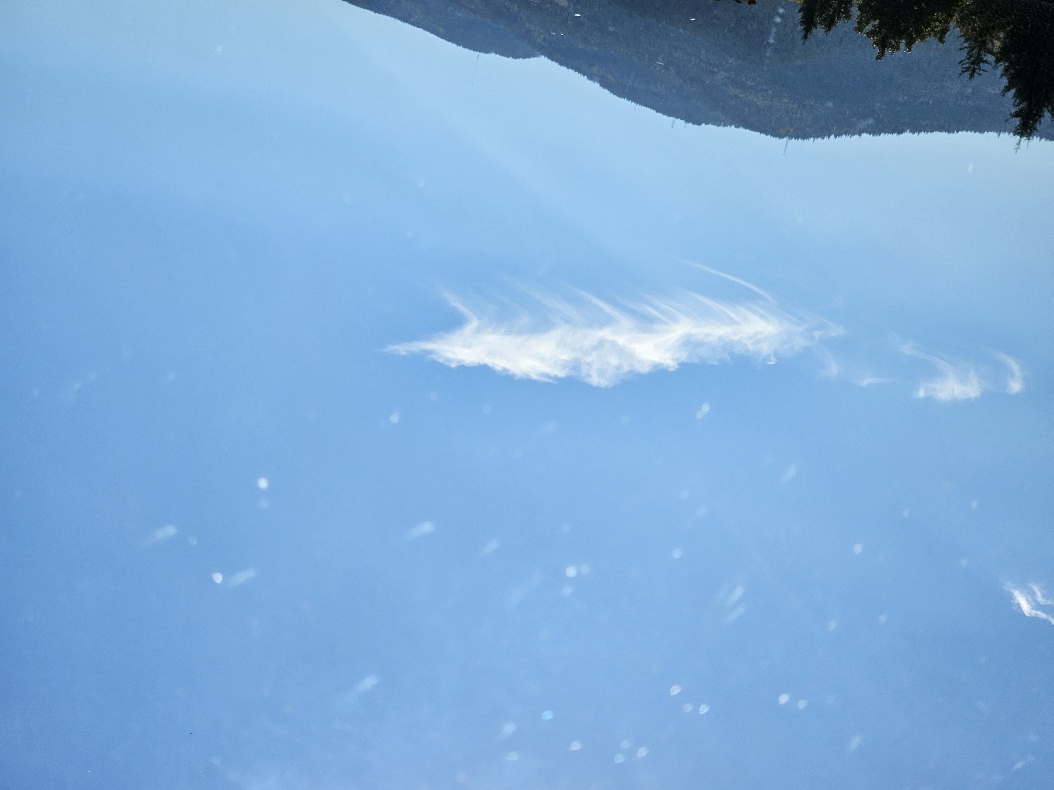
Cirrus
Thin, wispy, high-altitude clouds with delicate, hair-like structures displaying subtle wave patterns. Appears predominantly white against the clear blue sky withexcellent contrast. Has feathery, fibrous texture with minimal vertical extension. Cloud top appears slightly textured with fine, hair-like formations. No precipitation visible, positioned high in the sky with flat base.
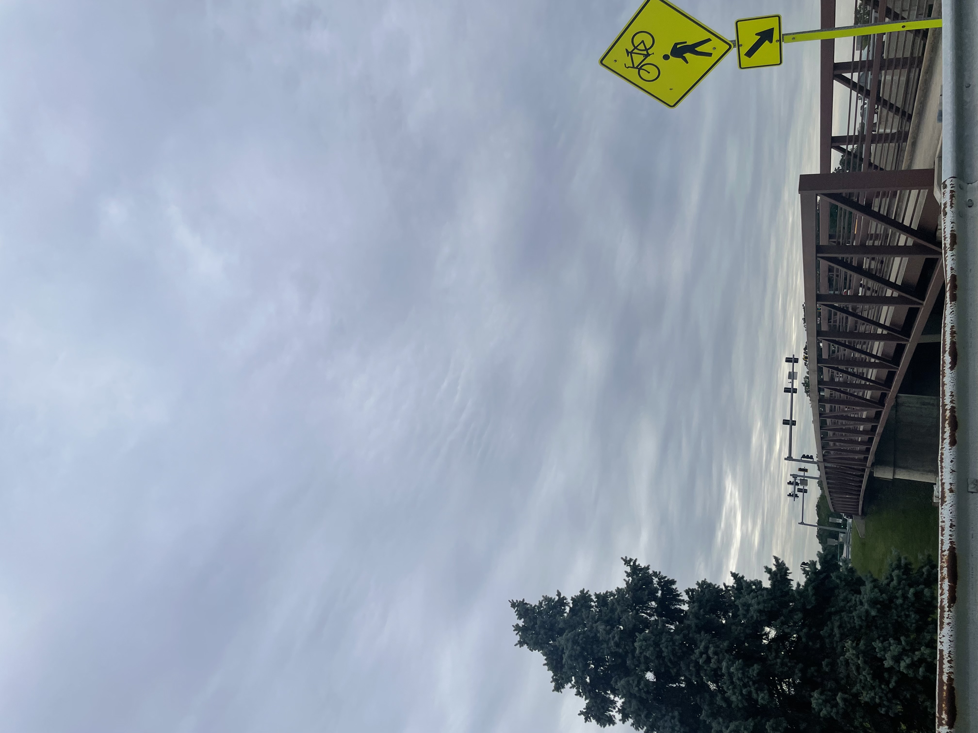
Stratocumulus
The identified cloud is Stratocumulus, characterized by extensive coverage of the sky with a relatively flat base featuring gentle, wave-like undulations creating textured patterns. The clouds exhibit a grayish hue with subtle brightness variations across their surface, showing soft, diffused edges without sharp boundaries. There is no significant vertical development, and the cloud tops maintain a gradual transition upward from the base. Precipitation is not visibly present, nor are halo or iridescence phenomena evident. The cloud base remains consistently elevated above the ground level, suggesting a mid-low altitude position.
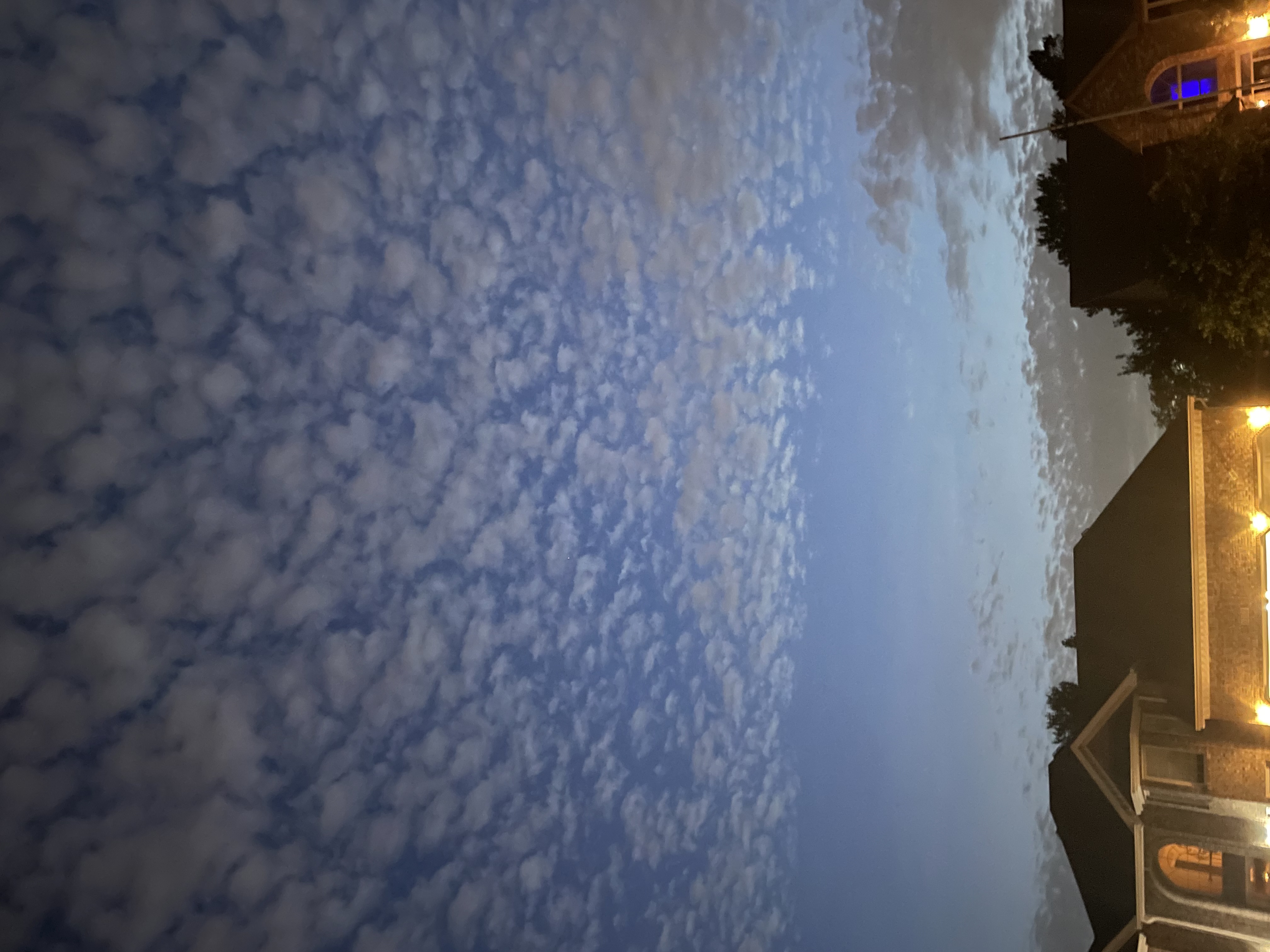
Cumulus humilis
The identified cloud consists of numerous small,rounded, white puffy formations with subtle gray undersides. Each cloud exhibits minimal vertical development, maintaining rounded domelike tops with slightly irregular edges. The clouds is soft and cotton-like, contrasting against the blue sky. Clouds are distributed without significant clustering, with bases appearing relatively uniform in elevation. No precipitation or halo phenomena are visible.
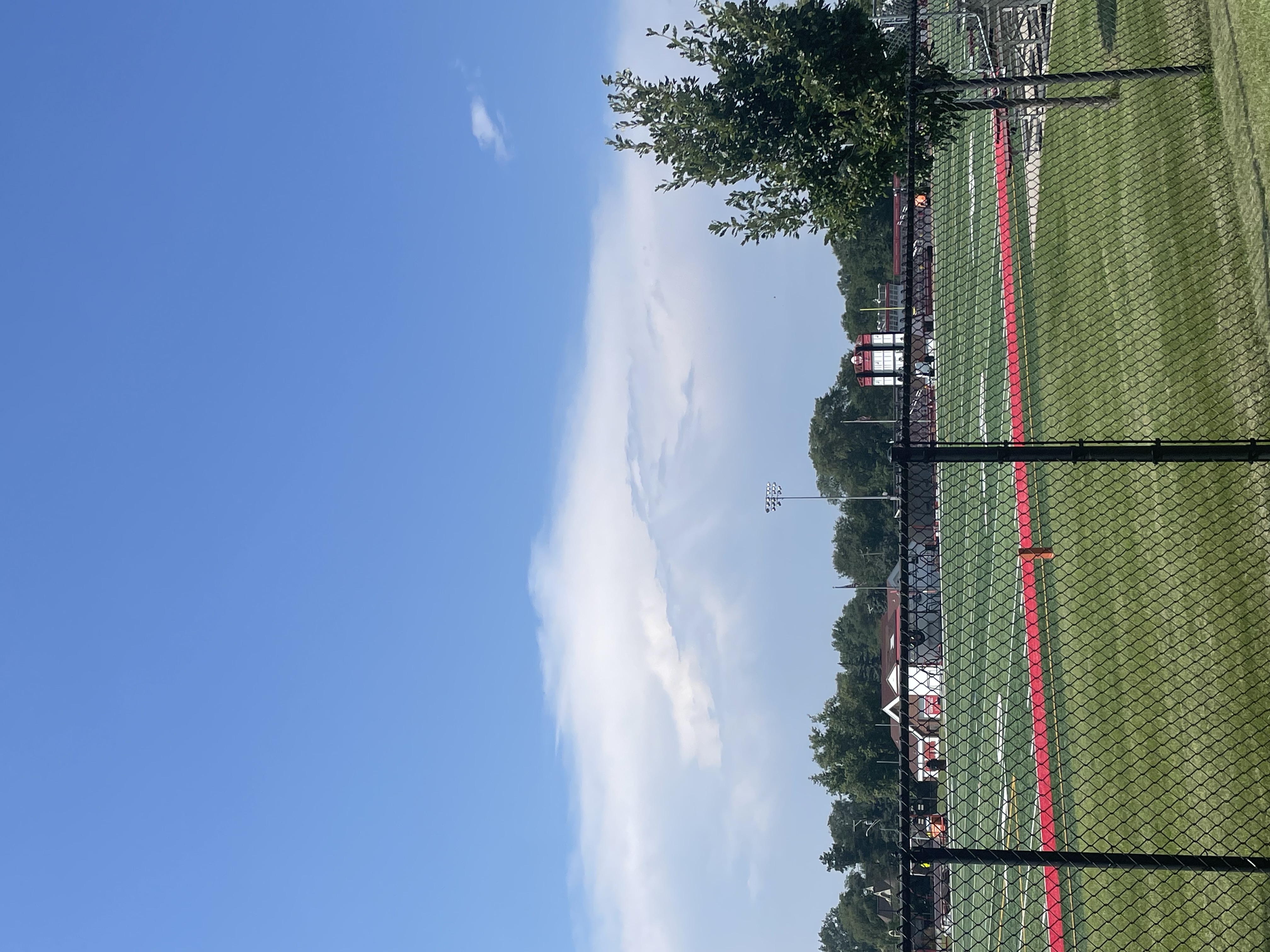
Cirrus
The identified cloud exhibits thin, wispy, and feathery texture with elongated, filamentous formations. It appears pale white against the deep blue sky, with smooth edges and no visible precipitation. Its shape is predominantly linear with subtle variations in density, indicating delicate ice crystal structures. The cloud has a high altitude placement, suggesting it forms at elevations of approximately 6-12 kilometers.
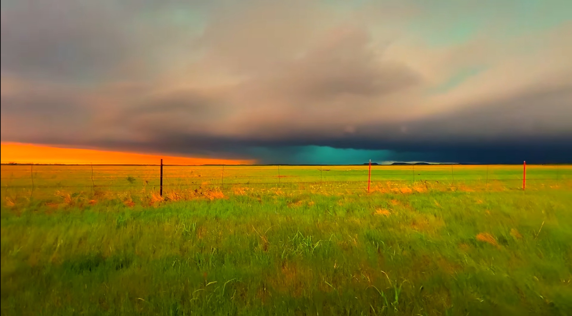
Cumulonimbus
Dominant cloud formation with extensive vertical development, dark gray/blackbase transitioning to lighter gray toward the anvil-shaped cloud top. The cloud exhibits a dense, textured appearance indicative of heavy moisture content. The base is relatively flat while the upper portions show characteristic anvil spreading due to wind shear at higher altitudes. A subtle turquoise hue near the cloud base may indicate updrafts and potential precipitation. The overall structure suggests a mature thunderstorm cloud system.
天空与天气学习者的选择
为什么用我们的云识别工具?
面向云分类、天气科普与高质量天空摄影
AI 云象识别
针对真实天空照片训练,区分主要云属、常见云种,识别更稳
秒级分类结果
快速得到云型、结构线索与背景说明,适合户外随手查、作业参考
结合气象学语境
将云型与典型天气、高度带、形成过程对应,贴近国际云图思路
免费体验
可先免费试用云识别;需要更多次数时再升级积分方案
移动端友好
手机随拍随传,手机、平板与电脑浏览器均可使用
讲解更完整
了解云体特征、拍摄建议,以及云层可能预示的天气变化
云识别与云分类如何工作
上传天空照片
上传或拍摄一张能清楚看到云层与天空背景的照片。
AI 分析
模型综合形状、纹理、高度线索与环境信息,推断最可能的云型。
查看报告
阅读分类结果、相似云型、典型天气与高度,并获取天空摄影建议。
云识别与云分类常见问题
什么是云识别?这里的“分类”指什么?
云识别是把你看到的云天现象对应到气象学中的云型名称(如积云、卷云)。分类通常依据云的外形、高度与结构,对应云属、云种、变种等国际云图体系。上传清晰天空照片后,AI 会给出最可能的云型并用通俗语言解释。
AI 云识别有多准?
准确度受照片质量、光线与场景典型程度影响。边缘清晰、色彩自然、天空背景充足,有助于区分相近云层(例如层云与雨层云)。结果宜作科普与学习参考,不能替代官方天气预报或航空气象资料。
这个工具免费吗?
可以先在免费额度内体验;若经常需要做云识别与分类,可升级获得更多积分。具体次数请查看价格页说明。
能识别哪些云型?
系统面向主要云属与常见云种,例如积云、层云、层积云、高积云、高层云、雨层云、卷云、卷积云、卷层云、积雨云等,以及在图像中可辨的相关变种。
什么样的照片最适合云识别?
尽量在白天拍摄,避免天空严重过曝,并包含云底、云顶或层状纹理等结构信息。全景往往优于极小局部;若太阳在云层后方,有时轮廓更清晰,利于分类。
可以在手机上用吗?
可以。网站适配手机端,可用系统相机拍照后上传,在户外或散步结束后随时查看识别与分类结果。